Navigating Wildfire Dangers: How Google Maps Can Help You Stay Safe
As wildfires continue to pose a significant threat to communities across the globe, staying informed and prepared has never been more critical. In the face of such a daunting challenge, technology has emerged as a powerful ally, with tools like Google Maps providing invaluable assistance to those in affected areas. By leveraging the platform’s innovative features, individuals can access real-time information about active wildfires, evacuation zones, and blocked roads, empowering them to make informed decisions and stay safe during these challenging times.
The Power of the Wildfires Layer
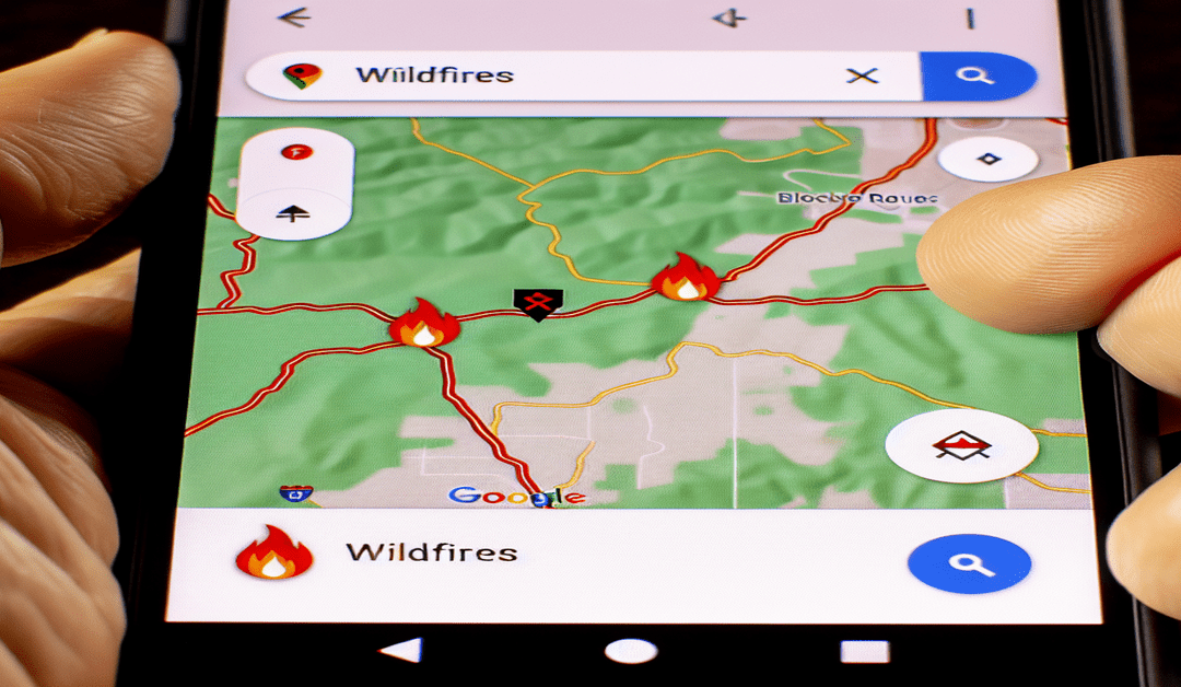
One of the most significant advantages of using Google Maps during a wildfire is the platform’s dedicated “Wildfires” layer. This feature, which may be labeled as “Bushfires” in some regions, allows users to view active wildfires directly on the map[1]. By simply turning on this layer, individuals can quickly identify areas that are currently affected by wildfires, enabling them to plan their routes and activities accordingly.
The visual representation of wildfires on Google Maps is intuitive and easy to understand. Affected areas are typically indicated by icons or red shapes, providing a clear picture of the extent and location of the fire[1]. However, it is essential to note that the accuracy of these representations may vary, depending on the available data and the rapidly changing nature of wildfires.
Accessing Detailed Wildfire Information
In addition to the visual representation of wildfires, Google Maps also offers users the ability to access more detailed information about specific fires. By simply tapping on a fire icon, individuals can view additional details, such as containment information and updates from local authorities[1]. This feature is particularly valuable for those who are in close proximity to a wildfire, as it allows them to stay informed about the latest developments and make decisions based on the most up-to-date information.
To further streamline the process of finding information about wildfires, Google Maps also allows users to search for specific fires by entering related queries in the search box. Additionally, in some cases, the platform may display a fire alert banner, which users can tap on to quickly access relevant information[1].
Navigating Evacuation Zones and Blocked Roads
While Google Maps is an invaluable tool for tracking the location and extent of wildfires, it is important to note that the platform generally does not provide detailed evacuation zone maps. However, this does not mean that Google Maps cannot be useful during an evacuation. By showing the location of fires and any blocked roads, the platform can help users navigate around affected areas and find safe routes to their destinations[5].
In the event of an evacuation, it is crucial to consult local emergency management resources and specific maps provided by local authorities. These resources will often have the most accurate and up-to-date information about evacuation zones and recommended routes. By using Google Maps in conjunction with these local resources, individuals can ensure that they have a comprehensive understanding of the situation and can make informed decisions about their safety.
Staying Connected and Informed
As the threat of wildfires continues to grow, it is more important than ever for individuals to stay connected and informed. By leveraging the power of tools like Google Maps, we can work together to keep our communities safe and resilient in the face of these challenges.
Whether you are a resident of an affected area, a first responder, or simply someone who wants to stay informed, Google Maps can be an invaluable resource. By familiarizing yourself with the platform’s wildfire-related features and staying up-to-date with local emergency resources, you can play an essential role in protecting yourself and your community during these difficult times.
As we move forward, it is clear that technology will continue to play an increasingly important role in our efforts to combat wildfires. By embracing innovative tools like Google Maps and working together as a community, we can build a safer, more resilient future for all.
#Wildfires #GoogleMaps #EvacuationZones #EmergencyPreparedness
-> Original article and inspiration provided by ReviewAgent.ai
-> Connect with one of our AI Strategists today at ReviewAgent.ai

